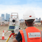
SCCS News

  1. Leica TS16 Total Station's utilised at London City Airport

    Leica TS16 Total Station's utilised at London City Airport
    Dyer and Butler, a multi-disciplined engineering service specialist, build, maintain and renew infrastructure within both the public and private sector, delivering engineering services and building projects thought the UK. A stunning photograph featuring a Leica TS16 Total Station supplied by SCCS was recently taken at London City Airport where Dyer and Butler are installing an attenuation drainage system which is...
  2. Using Multiple RTK GNSS on an HS2 Earthworks Project

    Using Multiple RTK GNSS on an HS2 Earthworks Project
    SCS Railways is a joint venture (JV) bringing together Skanska, Costain and STRABAG (SCS), an industry-leading partnership of global high-speed rail expertise and knowledge. This JV has a proven record in delivering major infrastructure, high-speed rail and some of the most iconic structures across the globe. A 30-year history of successful civil engineering projects has been delivered by Skanska and...
  3. Surveying existing water features with the Leica GS18 T RTK Rover

    Surveying existing water features with the Leica GS18 T RTK Rover
    Located centrally on the South Coast and covering the UK D G Yeatman Surveying & Engineering Ltd have over 36 years experience in all aspects of surveying including topographic, hydrographical, volumetric, as-built, monitoring and building. Providing a high level of service to clients as diverse as local builders to multinationals and local authorities. A recent project Darren Yeatman and his...
  4. Leica Geosystems GNSS Smart Antennas Comparison

    Leica Geosystems GNSS Smart Antennas Comparison
    With the recent launch of the new Leica GS18 I GNSS RTK Rover its a great opportunity to compare the impressive range of Leica Geosystems smart antennas. There are four GNSS smart antennas currently available in the current range, all impressive and include high levels of functionality and performance with the highest quality expected from a superior Leica Geosystems GNSS...
  5. Webinar: Introduction to the BLK360, capturing 3D reality at the push of a button

    Webinar: Introduction to the BLK360, capturing 3D reality at the push of a button
    The Leica BLK360 defines a new product category of its own: the laser imaging scanner. It is so small and light that it fits in a briefcase and can be carried almost anywhere. It has a measuring range of 60 meters for full captures. To get an idea, a full laser scan, 3D panoramic image capture, thermal imaging and transfer...

Items 26 to 30 of 416 total