Mapping out History
Johnson Poole and Bloomer (JPB) is an independent multidisciplinary engineering and scientific consultancy company, providing specialist engineering consultancy across the UK from their offices in Brierley Hill, Glasgow and Cardiff. Their aim to provide a personal, efficient and high-quality service that represents good value for money, with an overall objective to offer Practical Solutions to Technical Issues. Their particular areas of expertise are Geotechnical Engineering, Environmental Engineering, Contamination, Surveying, Mining and Quarrying.
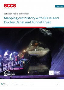
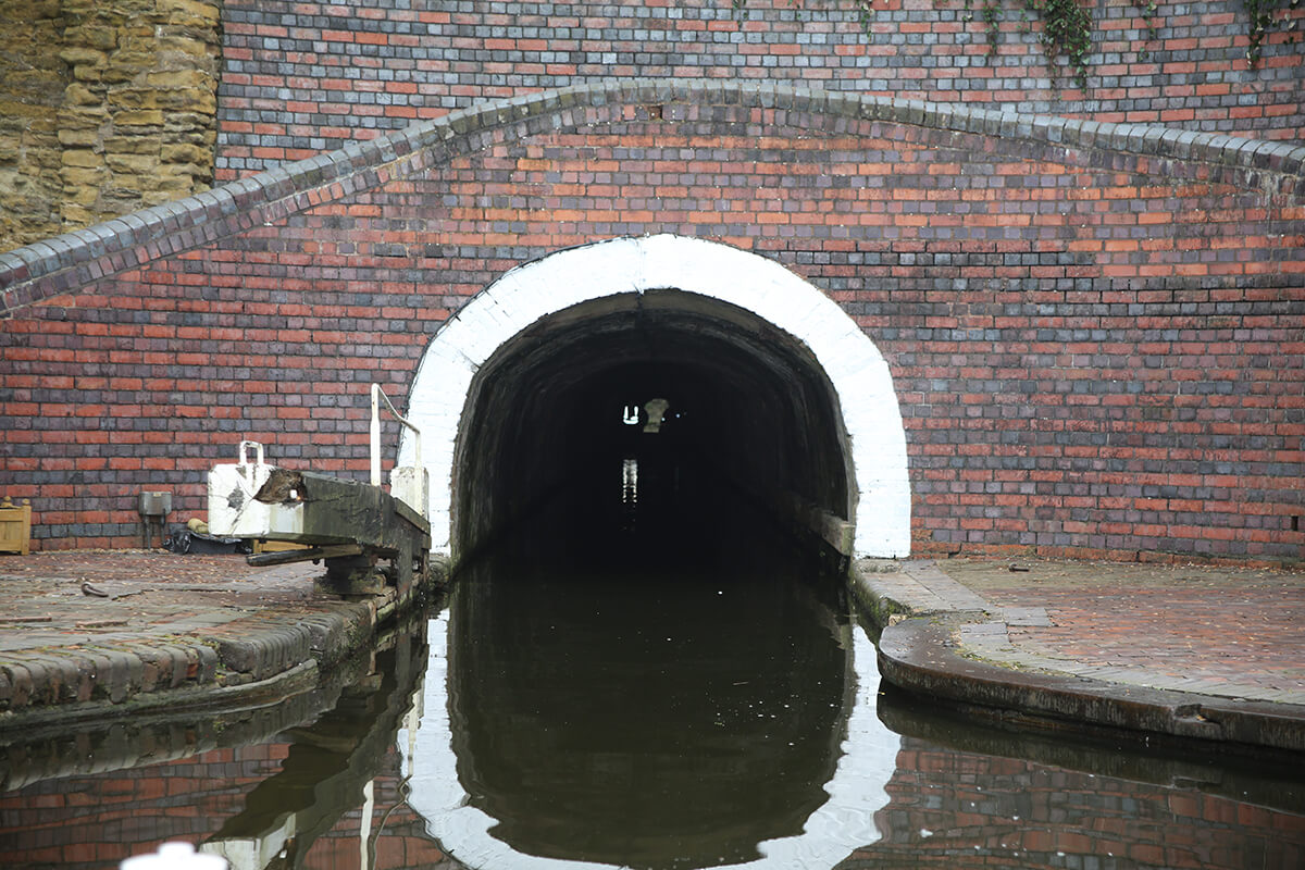 The entrance to the North portal of the Dudley Tunnel
The Dudley Tunnel is the second longest canal tunnel on the UK canal network, the main tunnel measuring over 2.5km long. Construction of the tunnel began over 240 years ago in 1775, and was first opened on 25th June 1791. The tunnel was constructed by Lord Dudley and Ward as a branch canal from the Birmingham Canal to the Tipton Colliery, and a 250-yard tunnel to the limestone mines under Castle Hill.
The tunnel remained in operation for over 170 years until it was closed in 1962. A collaboration between local volunteers (originally the Dudley Canal Tunnel Preservation Society, later the Dudley Canal and Tunnel Trust), and the local authority, Dudley Borough Council, led to the tunnel being reopened to the public as a tourist attraction in 1973.
The Dudley Canal and Tunnel Trust (DCTT) are responsible for the preservation of the canal, tunnels, and the unique underground caverns. Founded in the 1950’s, they became a heritage attraction in 1980, providing members of the public the unique tours into the 18th century abandoned mines built within the tunnel and the 19th century canal infrastructure which served the mines.
In late 2020, DCTT began to explore how new technology could help with their ongoing care and preservation of the system, help them to understand movements, stress points and produce a pro-active rather than reactive approach to their work.
The entrance to the North portal of the Dudley Tunnel
The Dudley Tunnel is the second longest canal tunnel on the UK canal network, the main tunnel measuring over 2.5km long. Construction of the tunnel began over 240 years ago in 1775, and was first opened on 25th June 1791. The tunnel was constructed by Lord Dudley and Ward as a branch canal from the Birmingham Canal to the Tipton Colliery, and a 250-yard tunnel to the limestone mines under Castle Hill.
The tunnel remained in operation for over 170 years until it was closed in 1962. A collaboration between local volunteers (originally the Dudley Canal Tunnel Preservation Society, later the Dudley Canal and Tunnel Trust), and the local authority, Dudley Borough Council, led to the tunnel being reopened to the public as a tourist attraction in 1973.
The Dudley Canal and Tunnel Trust (DCTT) are responsible for the preservation of the canal, tunnels, and the unique underground caverns. Founded in the 1950’s, they became a heritage attraction in 1980, providing members of the public the unique tours into the 18th century abandoned mines built within the tunnel and the 19th century canal infrastructure which served the mines.
In late 2020, DCTT began to explore how new technology could help with their ongoing care and preservation of the system, help them to understand movements, stress points and produce a pro-active rather than reactive approach to their work.
“Our goal is to produce engagement and interpretation materials for specialist and general public interest, as well as to raise the profile of the unique environment and produce a complete 360’ understanding of the system by viewing and scanning above ground, below ground and underwater and joining the three disparate layers together. We had to review and adapt our current monitoring and inspection approach and bring in new technology to achieve this.” Traci Dix-Williams - Chief Executive Officer, Dudley Canal and Tunnel Trust
 The overall goal of the Trust was to invest in a range of products and solutions, agreed with Historic England, for the purpose of full system scans and digital modelling. The information captured would be made available on a public platform projects running in 2021, with the further objective to apply for further funding to expand the project to include exploration of non-public areas.
JPB were contacted by the trust to provide them with a georeferenced point cloud model of their portal building, underground network of tunnels, caverns and woodland topography which can be subsequently processed in a multitude of ways to create the required outputs.
The overall goal of the Trust was to invest in a range of products and solutions, agreed with Historic England, for the purpose of full system scans and digital modelling. The information captured would be made available on a public platform projects running in 2021, with the further objective to apply for further funding to expand the project to include exploration of non-public areas.
JPB were contacted by the trust to provide them with a georeferenced point cloud model of their portal building, underground network of tunnels, caverns and woodland topography which can be subsequently processed in a multitude of ways to create the required outputs.
“The works were undertaken over a period of 18 days on site, and 10 days processing to get the required output. Additionally, we are also undertaking monitoring using the Leica P40 laser scanner on one of the pillars within Singing Cavern over a period of months from March up to September to allow Arup to create a theoretical FE stress test model using the data provided.” James Deacon – Geomatics Surveyor, Johnson Poole & Bloomer
A Unique Challenge
With the underground network being predominantly traversed solely by boat, the project required a unique approach on how to collect and connect the various environments in order to create a holistic model of the various environments. Additionally, being underground, there are only limited areas that have access to the external topography in order to connect to external control via total station/GNSS. With these challenges in mind, the team at JPB and DCTT utilised one of their smaller watercraft to carry a cross-tunnel support beam, upon which the Leica RTC360 laser scanner could be mounted at different points throughout the tunnel. Not only did this allow for the maximum amount of data to be captured, but also removed the risk of the scans being corrupted by the movements from the boat.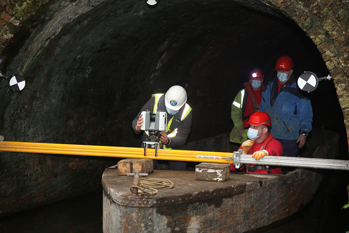 The team mount the RTC360 to the support beam at the entrance to the second stage of the tunnel
The Singing Cavern, the deepest publicly accessible section of the tunnels, had been experiencing some changes in its environment, dampness, shale movement and some rock falls. The usual inspection methods used by the trust were not able to capture this information. A pilot scan project in January 2019 gave them the details and evidence they required to expand the project to obtain a much better understanding of the tunnels and their stability and potential changes.
The team mount the RTC360 to the support beam at the entrance to the second stage of the tunnel
The Singing Cavern, the deepest publicly accessible section of the tunnels, had been experiencing some changes in its environment, dampness, shale movement and some rock falls. The usual inspection methods used by the trust were not able to capture this information. A pilot scan project in January 2019 gave them the details and evidence they required to expand the project to obtain a much better understanding of the tunnels and their stability and potential changes.
“Due to the system being flooded, evidence of a fall can be quickly lost underwater – we needed a more robust approach. We have never been able to fully line up the underground system with the above ground location.” Traci Dix-Williams - Chief Executive Officer, Dudley Canal and Tunnel Trust
A trend for change
Simplicity in design With the ability for mass data collection through a range of various reality capture equipment, such as Terrestrial Laser Scanners, Unmanned Aerial Vehicles, Hand-held Laser Scanners and Close-Range Photogrammetry, SCCS were able to apply a modern approach to deliver a product to the trust that had never been explored. With the caverns being a complex environment to map, it was decided to supplement traditional methodologies with reality capture equipment to create a product with various outputs. SCCS and Leica Geosystems have amassed a family of technologies and solutions that allow different challenges and environments to be overcome but without the compromise of having to utilise different software or quality to bring them together to create the required output.“Through Leica’s product solutions, we were able to address the survey control, the high precision monitoring, the topography mapping, the measured building surveying, the hand-held scanning areas of the tunnels and caverns and the fast terrestrial based scanning of the caverns, tunnels and buildings. All solutions were brought together in one piece of software to create the required product which would otherwise be require a number of different software suites adding time and complexity to the production of the required outputs.” James Deacon – Geomatics Surveyor, Johnson Poole & Bloomer
 For a project with the levels of complexity as the Dudley Tunnels, SCCS provided a simple to use, yet robust solution to JPB.
Of all the features in the products used on the project, the one feature that was highlighted above all is the approach to simplicity in design.
For a project with the levels of complexity as the Dudley Tunnels, SCCS provided a simple to use, yet robust solution to JPB.
Of all the features in the products used on the project, the one feature that was highlighted above all is the approach to simplicity in design.
“This can be especially seen with the RTC360 and the BLK2GO where the learning curve in its application on site is very minimal, with little to no requirement to learn the interface and equipment workflow. In addition to that, I found Register 360 to be extremely easy to use and process the reality capture datasets from the various equipment in order to create the required outputs, again cutting down the learning curve of utilising new software.” James Deacon – Geomatics Surveyor, Johnson Poole & Bloomer
Implementation
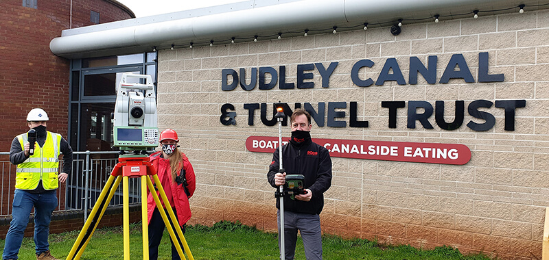
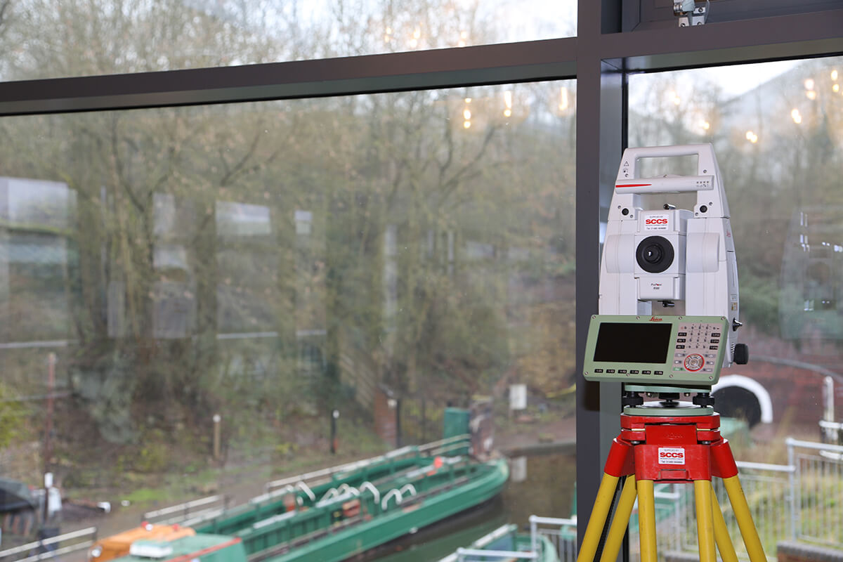 The Leica TS16, creating the control network with the tunnels
JPB utilised the Leica TS16 and GS18T to create the control network in two locations that were able to tie into the underground environment using Leica Circular Prisms and 4 ½” Black and White Tilt and Turn Targets. The BLK2GO solution was used to scan the woodland topography above the tunnels and caverns, as well as sections of the tunnels and within the portal building.
The Leica TS16, creating the control network with the tunnels
JPB utilised the Leica TS16 and GS18T to create the control network in two locations that were able to tie into the underground environment using Leica Circular Prisms and 4 ½” Black and White Tilt and Turn Targets. The BLK2GO solution was used to scan the woodland topography above the tunnels and caverns, as well as sections of the tunnels and within the portal building.
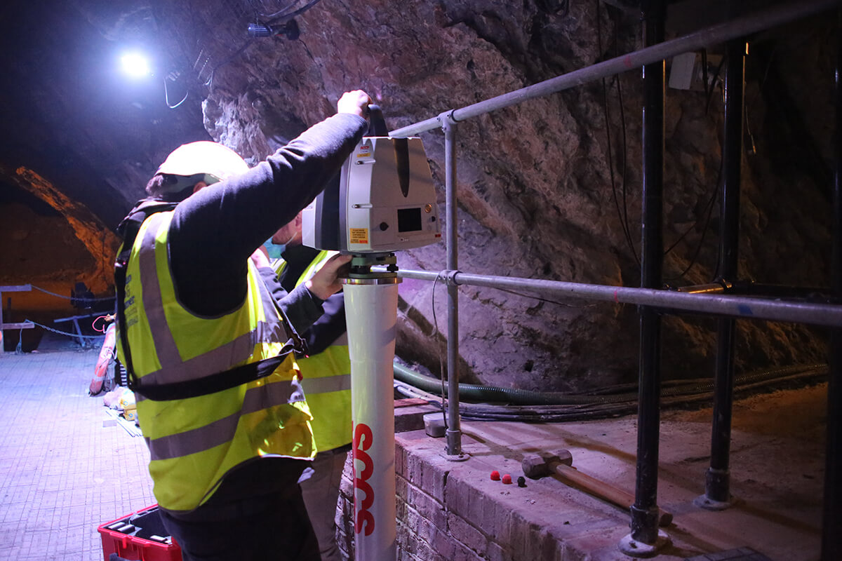
 With the unique challenge of scanning on water, the RTC360 was implemented throughout the tunnels on a prop and clamp system, and through the caverns on fixed pillars and tripods. The portal building was also scanned, both internally and externally with the RTC360 on a telescopic tripod system.
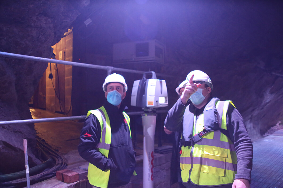
Finally, the P40 and NCTECH iStar were mounted on fixed Pillar positions throughout the biggest cavern, utilising the survey traverse functionality in order to accurately capture the required data through the pre survey control, as well as rapid collection of HDR images through the NCTECH camera solution.
With the unique challenge of scanning on water, the RTC360 was implemented throughout the tunnels on a prop and clamp system, and through the caverns on fixed pillars and tripods. The portal building was also scanned, both internally and externally with the RTC360 on a telescopic tripod system.
Finally, the P40 and NCTECH iStar were mounted on fixed Pillar positions throughout the biggest cavern, utilising the survey traverse functionality in order to accurately capture the required data through the pre survey control, as well as rapid collection of HDR images through the NCTECH camera solution.
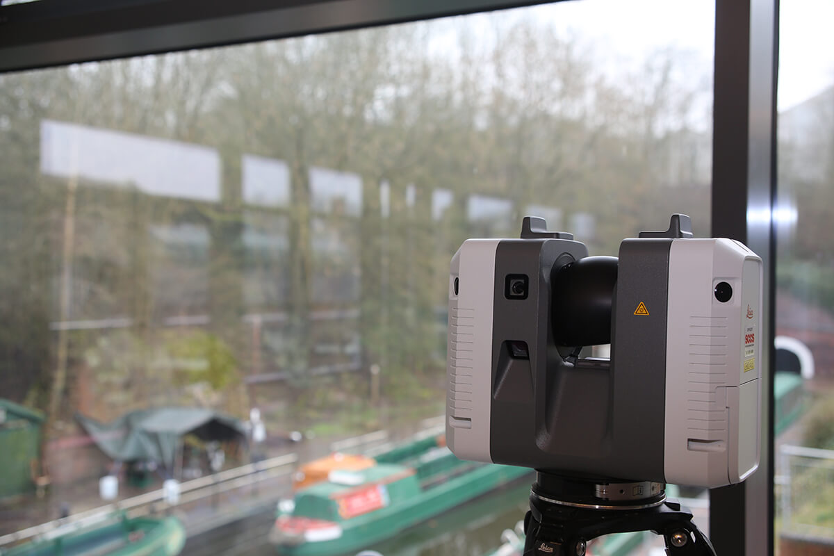
 The Leica P40 being mounted on fixed pillars throughout the caverns
James Phillips, Field Sales Representative and Phil March, UK Sales Manager - Reality Capture, conducted various site and virtual meetings before the project began to discuss which solutions could be used and the benefits of the different solutions within the various unique and testing environments. From that, James also visited the site to test and ensure that the solutions that had been hypothesized would be suitable for when the project started. This enabled all parties to resolve any teething problems before the work commenced.
The Leica P40 being mounted on fixed pillars throughout the caverns
James Phillips, Field Sales Representative and Phil March, UK Sales Manager - Reality Capture, conducted various site and virtual meetings before the project began to discuss which solutions could be used and the benefits of the different solutions within the various unique and testing environments. From that, James also visited the site to test and ensure that the solutions that had been hypothesized would be suitable for when the project started. This enabled all parties to resolve any teething problems before the work commenced.
“My initial reaction to the products in use was the immense simplicity and ease of use of their application. Additional to that was the simplicity and adaptability of the different solutions within the different environment, creating confidence that a solution would be found to any problems that occurred. There was a huge reaction to the outputs of the HDS solutions from me from a survey perspective in terms of the accuracies achieved within the environments and the registration of the data. The client was extremely impressed with information picked up and displayed from the HDS solutions that detailed the underground environment that had otherwise never been seen, allowing for questions to be answered straight from the software that had been elusive beforehand.” James Deacon – Geomatics Surveyor, Johnson Poole & Bloomer
Complete and unique environment mapping
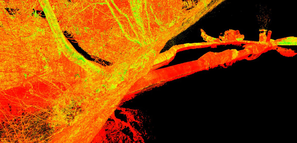 3d mapping of the north tunnel
The various solutions implemented enabled the environment to be mapped and viewed spatially in a completely unique way, allowing for reliable data analysis and dissemination. The solutions provided by SCCS and Leica Geosystems has opened previously unavailable opportunities and a plethora of benefits for DCTT to explore uses with the data that can supplement current and future operations, such as health and safety flythroughs, augmented & virtual reality, monitoring and conservation recording.
The solutions implemented have both saved time and increased productivity through both the capability of the equipment in the environments but also the solutions speed of data capture. This has enabled JPM to tackle the challenging environments within the projects time constraints without a detriment to the quality of data captured.
JPM have made plans to implement all the used solutions within future projects where they can be utilised, as well as part of the ongoing inspections within the cavern environments. DCTT will use the equipment and technology as an integral part of their ongoing inspection approach.
3d mapping of the north tunnel
The various solutions implemented enabled the environment to be mapped and viewed spatially in a completely unique way, allowing for reliable data analysis and dissemination. The solutions provided by SCCS and Leica Geosystems has opened previously unavailable opportunities and a plethora of benefits for DCTT to explore uses with the data that can supplement current and future operations, such as health and safety flythroughs, augmented & virtual reality, monitoring and conservation recording.
The solutions implemented have both saved time and increased productivity through both the capability of the equipment in the environments but also the solutions speed of data capture. This has enabled JPM to tackle the challenging environments within the projects time constraints without a detriment to the quality of data captured.
JPM have made plans to implement all the used solutions within future projects where they can be utilised, as well as part of the ongoing inspections within the cavern environments. DCTT will use the equipment and technology as an integral part of their ongoing inspection approach.
 Download the PDF
 Heritage Protection Commissions
Historic England offers funding to develop a strategic understanding of our shared historic environment, to develop innovative ways to protect it from harm and to enrich skills and expertise to help care for it.
About Historic England
Historic England are the public body that helps people care for, enjoy and celebrate England’s spectacular historic environment, from beaches and battlefields to parks and pie shops. They protect, champion and save the places that define who we are and where we’ve come from as a nation. They care passionately about the stories these places tell, the ideas they represent and the people who live, work and play among them. Working with communities and specialists they share our passion, knowledge and skills to inspire interest, care and conservation, so everyone can keep enjoying and looking after the history that surrounds us all. They fundraise from individuals, charitable trusts and foundations and public sector bodies to enable them to deliver those aspects of their work that are not funded by their Government grant.
SCCS - The Survey Equipment Company
SCCS, part of Hexagon, takes pride in the extensive range of high-quality products and level of service offered. Known for providing the most comprehensive range of technologically advanced hardware and software equipment, together with solutions for positioning and measuring. With years of experience in providing a quality service to the civil engineering, surveying and construction industries SCCS are committed to innovating the service provided to customers by adding new surveying, monitoring, scanning, and other geo referencing products, solutions and services. Today with an ongoing investment in the hire fleet SCCS continue to commit to finding solutions using the most advanced technology and a support team which is among the most experienced in the UK.
Heritage Protection Commissions
Historic England offers funding to develop a strategic understanding of our shared historic environment, to develop innovative ways to protect it from harm and to enrich skills and expertise to help care for it.
About Historic England
Historic England are the public body that helps people care for, enjoy and celebrate England’s spectacular historic environment, from beaches and battlefields to parks and pie shops. They protect, champion and save the places that define who we are and where we’ve come from as a nation. They care passionately about the stories these places tell, the ideas they represent and the people who live, work and play among them. Working with communities and specialists they share our passion, knowledge and skills to inspire interest, care and conservation, so everyone can keep enjoying and looking after the history that surrounds us all. They fundraise from individuals, charitable trusts and foundations and public sector bodies to enable them to deliver those aspects of their work that are not funded by their Government grant.
SCCS - The Survey Equipment Company
SCCS, part of Hexagon, takes pride in the extensive range of high-quality products and level of service offered. Known for providing the most comprehensive range of technologically advanced hardware and software equipment, together with solutions for positioning and measuring. With years of experience in providing a quality service to the civil engineering, surveying and construction industries SCCS are committed to innovating the service provided to customers by adding new surveying, monitoring, scanning, and other geo referencing products, solutions and services. Today with an ongoing investment in the hire fleet SCCS continue to commit to finding solutions using the most advanced technology and a support team which is among the most experienced in the UK.