The Viva GNSS App is the perfect tool for all professionals working with precision GNSS systems. The app simulates a Leica Viva series field controller and connects to the Leica Geosystems online satellite availability service to help you determine the ideal measuring times for any location. Thanks to the availability indicator you can see how many different GPS and GLONASS satellites are currently available and the satellite availability trend for your exact location. The Viva GNSS App also provides you with current and expected DOP values, essential indicators for precision measuring with GNSS systems.
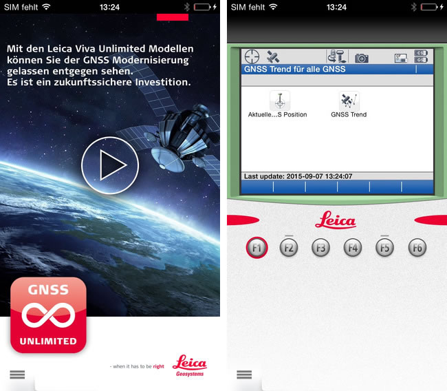
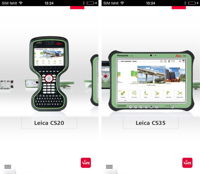 Use the Viva GNSS App to determine your WGS84 Latitude, Longitude and Height, clearly displayed in the Leica Viva style user interface. This multi-lingual app also provides an interactive insight into the key factors that influence GNSS technology. Use the 360° view to discover the right instrument for you and discover its inner workings in detail.
What's New in Version 2.2
Use the Viva GNSS App to determine your WGS84 Latitude, Longitude and Height, clearly displayed in the Leica Viva style user interface. This multi-lingual app also provides an interactive insight into the key factors that influence GNSS technology. Use the 360° view to discover the right instrument for you and discover its inner workings in detail.
What's New in Version 2.2
- new products - filed controllers Leica CS20 and CS35
- new Leica Viva GNSS Future video
- Optimized app performance