FREE upgrade to all SCCS customers who are currently using MicroSurvey STAR*NET on an existing maintenance contract.
Excellent offers for all new or existing out of software maintenancecustomers, please contact us for details.

MicroSurvey Software Inc. is pleased to announce the release of MicroSurvey STAR*NET 8.2, the latest and highly anticipated version of the industry-leading STAR*NET least squares network adjustment suite.
Full Details: starnet82-features-benefits.pdf
Brian Sloman, Development Manager at MicroSurvey and Product Manager for STAR*NET, explains that "
STAR*NET 8.2 is all about saving time and money! Network adjustments run much faster than previous versions, and the new Adjust Network with Cluster Detection command lets you combine measurement data for points with different names that fall within a specified 2D or 3D proximity of each other! Users no longer have to spend hours tediously pouring through their data files and field books looking for point IDs that need to be manually changed, a common scenario which is both time intensive and prone to mistakes. Having an effective distance displayed alongside the angular residuals in the Listing file makes it easier to analyze the adjustment results and identify problems like an incorrect prism pole height, and we've made many improvements to the various data conversion utilities and GPS vector imports that make it easier to use STAR*NET to process data from FieldGenius, Leica, Carlson, Trimble, TDS, and other data collectors."
What's New in STAR*NET 8.2
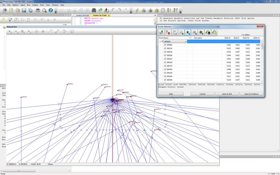
Adjust Network with Cluster Detection
A new adjustment method "Adjust Network with Cluster Detection" is now available, which will automatically detect multiple points that are within a specified 2D or 3D proximity of each other and treat them as one point during the adjustment. Specify a 2D or 3D distance tolerance, and choose whether or not to include or exclude points that are beyond tolderance of the key point in the cluster but within tolerance of any other point in the cluster. A dual-pass adjustment will be performed, whereby a complete adjustment will first be run with all iterations, then its results analyzed to determine which points to combine, and a second adjustment will be run with those points aliased together. After the first adjustment, you will have full control to approve or override any aliasing decisions prior to running the second adjustment, including the ability to control which point ID to use for each cluster. After the final adjustment, the listing file will report which points were aliased together in each cluster and will display their deltas from the true point.
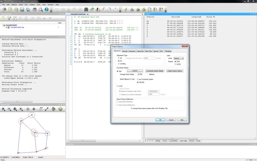
 Input/Output Ellipsoid
A new option has been added to the Project and Company Options, allowing you to specify which ellipsoid you want to use for all input and output involving latitude/longitude values and ellipsoid heights such as P data records, the Geotetic Position (.pos) file, and the Listing (.lst) file. STAR*NET V6 and V7 always used the reference ellipsoid for the project's selected coordinate system, and in STAR*NET V8.0/8.1 this behaviour changed to always use WGS84.
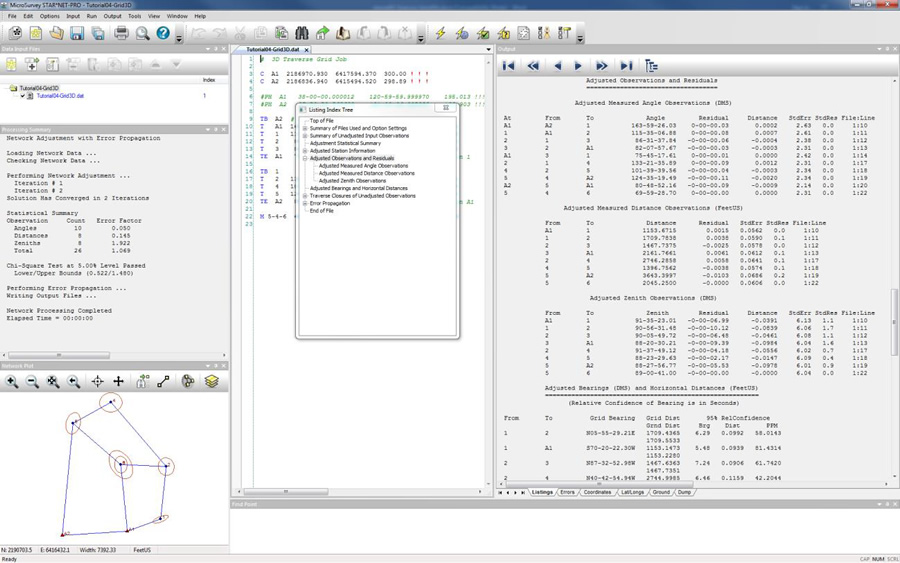
 Adjusted Observations and Residuals
The Listing file will now report a effective distance value along with any angular residuals in the "Adjusted Observations and Residuals" section. This makes it easier to interpret the angular residuals without having to cross-reference it against the slope distance of the measurement.
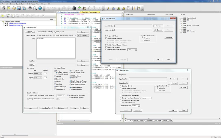
 Conversion Utilities & GPS Vector Import
Many improvements to several of the data conversion utilities and GPS vector importers including MicroSurvey FieldGenius, Leica DBX, Carlson SurvCE, TDS Survey Pro, Trimble JobXML, and others.