We are pleased to offer a 40% discount on MicroSurvey STAR*NET 9 - available until the end of October 2017. For more information and to order now, email sales@sccssurvey.co.uk, click here to buy online or call 01480 404888.
SCCS News
-
About MicroSurvey STAR*NET 9 Upgrade
What is new in MicroSurvey STAR*NET 9, compared to my old Starplus STAR*NET or MicroSurvey STAR*NET V6? MicroSurvey STAR*NET 7, 8 and 9 feature a highly customizable integrated data editor, a powerful new Find Point tool to locate all input records for a particular point by double-clicking a point in any of the output files, loop closure checks for GPS... -
Leica Geosystems iXE CoPilot System
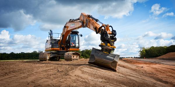
SCCS, in collaboration with engcon and Warwick Ward Case, have supplied and installed NT Killingley with a brand new Leica Geosystems IXE3 dual mast GNSS excavator system with integrated Leica CoPilot. The new Leica Geosystems iXE CoPilot system allows the operator to concentrate on controlling the digging movement (boom, arm, bucket and slew of the machine) while the tilt... -
Digital Construction
There is a digital revolution within the construction industry, where the world of survey and measurement is shifting the way technology supports BIM (Building Information Modelling). BIM has an enormous role to play in sculpting the future of digital construction. It is pushing digitisation to develop communication between the office and the construction site to ensure a consistent workflow, digital... -
INTERGEO Conference Trade Fair - Berlin 2017
SCCS will be attending this years INTERGEO 2017 in Germany's capital Berlin. Intergeo is the world’s leading conference trade fair for geodesy, geoinformation and land management. The trade fair covers a wide variety of fields, ranging from surveying, geoinformation, remote sensing and photogrammetry to complementary solutions and technologies. Processing, using and analysing geodata on the Internet or in the...
